
NEW DELHI–Apple has introduced a redesigned version of Apple Maps in India, adding interactive street-level imagery, more than 300 three-dimensional landmarks and navigation features tailored to the country’s roads and transportation networks.
The update, announced Wednesday, includes improved navigation instructions, expanded language support, augmented reality walking directions and public transit information across major Indian cities.
One of the key additions is Look Around, Apple’s interactive street-level imagery feature, which allows users to virtually explore streets, neighborhoods and landmarks across India. The feature also enables users outside the country to explore Indian locations through Apple Maps.
“Apple Maps is the best way to explore and navigate the world and we are excited to bring an enhanced Maps experience to even more users with today’s rollout of the new map in India,” said Max Muller, Apple’s Vice President of Apple Maps.
The redesigned service introduces enhanced Natural Language Guidance, which provides more conversational driving directions using familiar landmarks and real-world references.
The feature is designed to improve navigation in areas where street names may be missing, inconsistent or difficult to identify.
Apple has also expanded its language capabilities, introducing dual-language map labels that display English alongside regional languages based on a user’s settings and location.
In addition to Hindi, Apple Maps now supports Bengali, Gujarati, Kannada, Malayalam, Marathi, Tamil, Telugu, Punjabi, Odia and Urdu.
Drivers will have access to several additional navigation tools, including lane guidance, multi-stop routing for journeys involving up to 15 destinations and the ability to share estimated arrival times.
The update also supports traffic incident reporting through Siri and route planning for electric vehicles.
For pedestrians, Apple has introduced augmented reality walking directions that use an iPhone camera to display navigation instructions over real-world surroundings.
Public transportation features have also been expanded, allowing commuters in Ahmedabad, Bengaluru, Chennai, Delhi, Hyderabad, Kolkata, Mumbai and Pune to plan journeys, identify nearby transit stations and receive notifications as they approach their destinations.
Indian Railways passengers can also use the service to plan trips and receive navigation assistance.
Cyclists will benefit from new routing options that include elevation information, helping users assess terrain and plan more suitable journeys.
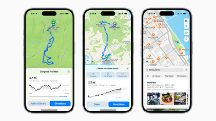
Other additions include custom route creation and Preferred Routes, a feature that uses on-device intelligence to recognize frequently traveled routes and provide personalized commuting suggestions.
Apple emphasized that the redesigned Maps experience includes privacy protections intended to limit the collection and sharing of personal information.
The company said users are not required to sign in to Apple Maps, while personalized features are processed through on-device intelligence.
Information collected through the service is associated with randomly generated identifiers that reset periodically. Apple also uses a process designed to obscure users’ precise locations when processing location searches on its servers.
The redesigned Apple Maps experience, including enhanced Natural Language Guidance and dual-language labels, is available on compatible devices running iOS 27.2, iPadOS 27.2, watchOS 27.2 and macOS 27.2 or later.
The rollout represents a significant expansion of Apple’s mapping capabilities in India, where the company is introducing navigation tools designed to accommodate the country’s diverse languages, transportation systems and road infrastructure. (Source: IANS)